
Hurricane Laura Lashes Gulf Coast
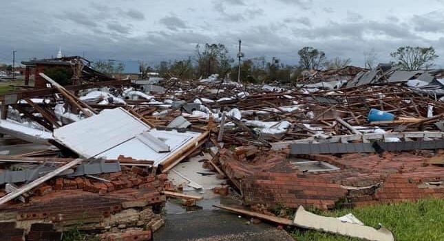
Hurricane Laura made landfall in the early hours of Thursday morning, bringing sustained winds of up to 150 mph. As the northern eyewall of the hurricane raced over Cameron Parish, Louisiana, NOAA’s Hurricane Center issued an update urging all to “Take action now to protect your life!”
The Category 4 hurricane was forecast to strike southwestern Louisiana with a “catastrophic storm surge, extreme winds and flash flooding.” Earlier in the day, social media users were talking about an “unsurvivable storm surge,” while authorities were urging people to evacuate, and for those who chose to stay, to write their name, address, social security number and next of kin, and carry the information in their pocket in a Ziploc bag. “Praying that it does not come to this,” the Vermilion Parish Sheriff’s Office said.
After her initial landfall Laura was downgraded to a Tropical Depression, but not before causing a trail of destruction and killing at least six people. According to The New York Times four of the people died in separate incidents when trees fell onto the homes in which they were sheltering; a 24-year-old man died of carbon monoxide poisoning in his home; and a man drowned when his boat sank. The storm then continued to track across the state, causing widespread damage throughout southwestern Louisiana and leaving thousands of people without power or water.
Damaging winds and heavy rains are continuing as the depression moves slowly northeast. As of 7 a.m. (PDT) NOAA advised that flash floods are possible for portions of northeast Arkansas, southeast Missouri, western Kentucky and Tennessee, northern Mississippi, and northwest Alabama, with some regions expecting up to five inches of rain.
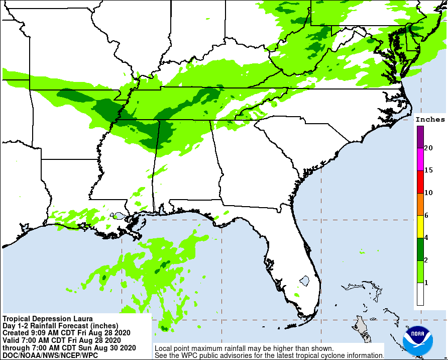
Laura is expected to cross the mid-Atlantic coastline by late Saturday and be absorbed by an approaching cold front.
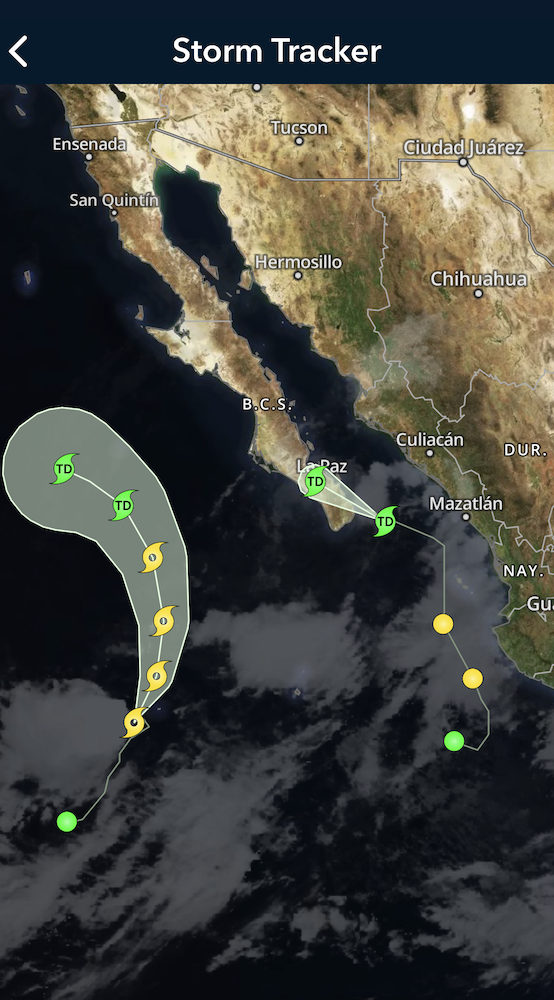
Meanwhile, in the Eastern Pacific, two unnamed weather systems we reported on last Friday are now known as Tropical Depression Hernan and Tropical Storm Iselle. Hernan is currently moving northwest across the southern tip of the Baja Peninsula with wind speeds of less than 39 mph. As of 8 a.m. today, Iselle was situated at 18.3°N 115.3°W, moving northeastward with winds of around 60 mph. She is expected to begin weakening late tonight.
As always, stay safe out there, wherever you may be.