
Hurricane Debby and Pacific Ocean Hurricanes
The hurricane season is well underway. Hurricane Debby has made landfall as a Category 1 hurricane with 80-mph winds hitting the northeastern corner’s Big Bend region of Florida’s Gulf Coast. According to the National Hurricane Center the storm will bring a six- to 10-ft storm surge and heavy rainfall along the coast before crossing to Georgia and the Carolinas, where they expect more storm surge and flooding from the rain. There is very little tide in these regions, so most docks are not built to rise and fall, though 10 feet above “normal” would likely overwhelm any dock arrangements.
According to CNN, Hurricane Debby made landfall just nine miles from where Hurricane Idalia landed last year.
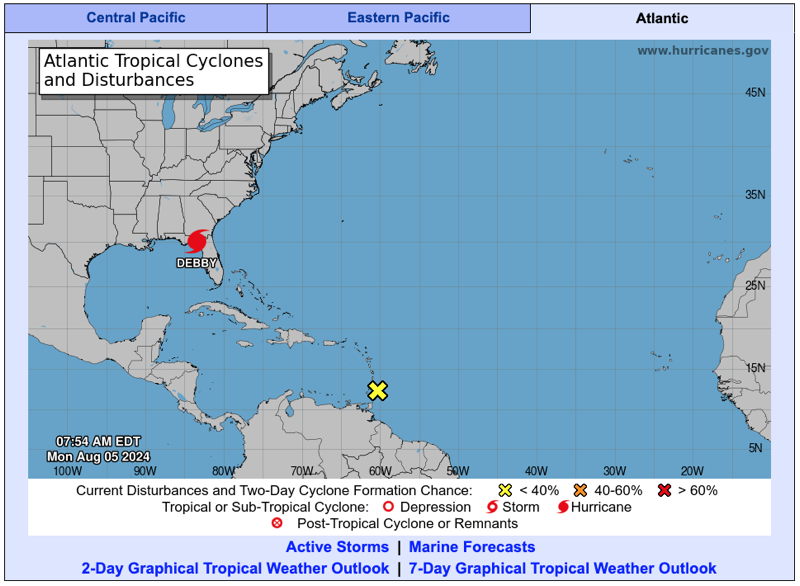
While Debby is landing in Florida, another tropical depression is crossing the Windward Islands near the Grenadines, which were recently ravaged by Hurricane Beryl. NOAA will be keeping an eye on this, hoping it won’t turn into a hurricane as it travels the warm waters of the western Caribbean.
Weather like this reminds us how much we appreciate NOAA and what would happen under privatization as proposed under Project 2025. NBC Bay Area reported that Saildrone in Alameda has one of its autonomous drones sailing in Hurricane Debby to help researchers better understand and forecast the storms. See the NBC report here.
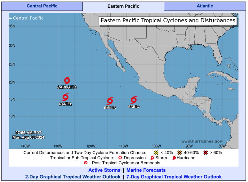
Meanwhile, the National Hurricane Center’s map of the Pacific makes it clear why boats don’t head from the West Coast to the Marquesas at this time of year. There are four named storms, Carlotta, Daniel, Emilia and Fabio, all to the west of Mexico with their projected paths showing them likely to continue heading harmlessly westward.
As we learned once again last year, things can change quickly. In the current issue of Latitude 38, Tim Henry wrote about the Acapulco Yacht Club’s continuing recovery from Hurricane Odile after it strengthened from a tropical storm to a Category 5 hurricane less than 24 hours before hitting Acapulco.